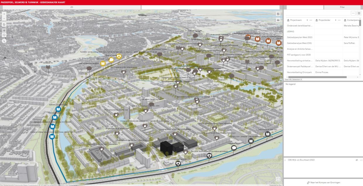
A lot is happening in and around the neighborhoods of Selwerd, Paddepoel, and Tuinwijk (SPT). This area analysis aims to provide an overview of the many dynamic developments and investigate whether there is cohesion between different interventions. By approaching from the perspective of public space, the analysis focuses on improving livability through an integrated approach that encompasses both physical and social aspects. Given the impending budget cuts in 2026, it is important to have a well-founded and integrated story about municipal real estate and its efficient use in the interest of residents.
Role and Contributions:
-
Data Collection:
- Collected data on spatial and social conditions within the SPT neighborhoods.
- Ensured the accuracy and relevance of the collected data to support the analysis and proposals.
-
Map Creation:
- Created detailed maps to visualize various aspects of the neighborhoods, including current conditions and proposed changes.
- Used GIS tools to effectively integrate and present spatial data.
-
Support for Analysis and Proposals:
- Provided crucial data and visualizations that informed the comprehensive area analysis.
- Helped identify opportunities to enhance the cohesion and impact of various interventions.
-
Collaboration with Stakeholders:
- Worked closely with the Urban Renewal Master and Social Master to ensure the integration of physical and social domains.
- Participated in discussions and planning sessions to align data-driven insights with strategic objectives.
-
Creation of a GIS Web Application:
- Developed a GIS web application that gathered all spatial information about projects in SPT.
- Created an initial version of a dynamic map of SPT with all important projects and ideas in the area.
Key Outcomes and Impact:
- Comprehensive Area Analysis: Produced a thorough analysis that provided a clear overview of ongoing and planned activities in the SPT neighborhoods.
- Strategic Insights: Identified opportunities to enhance the cohesion and impact of various interventions.
- Visual Support: Created maps and visual tools that facilitated understanding and communication of complex data and proposals.
- Integrated Approach: Contributed to the development of an integrated approach to public space that balanced both physical and social considerations.
- Action-Oriented Agenda: Supported the formulation of an agenda with follow-up actions to improve public space and overall livability in Selwerd, Paddepoel, and Tuinwijk.
- Living Map: Introduced a living map that provides a dynamic and up-to-date representation of all important projects and plans in the SPT neighborhoods, improving transparency and accessibility of information for stakeholders.

